Link copied. Paste the link into Instagram to share the route.

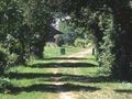
El Eje Verde nació de una idea original que llevó a transformar una antigua vía de tren en un camino para senderismo, con las antiguas estaciones adaptadas en alojamientos. Desde Guise hasta las puertas de Hirson, con un prolongamiento hasta la abadía de Saint-Michel, el Eje Verde acompaña al Oise, que desciende de Bélgica. En el paisaje sereno de este valle, adornado aquí y allá con grupos de álamos, el río deja a sus lados algunos pantanos y estanques propicios para la pesca y la observación de aves. A lo largo de casi 40 km, el camino se extiende, despejado, señalizado con hoteles y alojamientos, abierto también a otras aventuras (descensos en canoa desde los embarcaderos de Guise, de Étréaupont, de Autreppes o de Hirson, o al descubrimiento de una rica memoria industrial alrededor de Hirson).
See something wrong on this route?Add an issue
Navigate route in...
 RouteYou app Open
Don't want to see this ad anymore?
→ Upgrade now

Please wait, the navigation is being prepared.
You can now navigate. Have fun on the road!
Processing your request has failed. Please try again.
Don't want to see this ad anymore?
→ Upgrade now
Please wait, your download is being prepared.
Your download is ready. Have fun on the road!
Processing your request has failed. Please try again.
Don't want to see this ad anymore?
→ Upgrade now
Please wait, your print is being prepared.
Your print is ready to download. Have fun on the road!
Processing your request has failed. Please try again.
Additional feedback:
This feature is only available to RouteYou PREMIUM subscribers.
Try 1 month for free and discover the difference! We don't take any payment details, and your trial ends automatically after one month.
© 2006-2026 RouteYou - www.routeyou.com



 Aisne - Balades sur RouteYou






 Start
Start Download
 Download

