Link copied. Paste the link into Instagram to share the route.

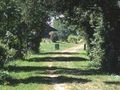
L'Asse Verde è nata da un'idea originale che ha portato a trasformare una vecchia ferrovia in un sentiero per passeggiate, con le vecchie stazioni trasformate in alloggi. Da Guise alle porte di Hirson, con un prolungamento fino all'abbazia di Saint-Michel, l'Asse Verde accompagna l'Oise, che scende dal Belgio. Nel paesaggio sereno di questa valle, ornate qua e là da gruppi di pioppi, il fiume abbandona sulle sue rive alcune paludi e stagni favorevoli alla pesca e all'osservazione degli uccelli. Su quasi 40 km, il sentiero si estende, libero, segnalato da hotel e alloggi, aperto anche ad altre avventure (discese in canoe-kayak dai punti di imbarco di Guise, Etréaupont, Autreppes o Hirson, o alla scoperta di un ricco patrimonio industriale attorno a Hirson).
See something wrong on this route?Add an issue
Navigate route in...
 RouteYou app Open
Don't want to see this ad anymore?
→ Upgrade now

Please wait, the navigation is being prepared.
You can now navigate. Have fun on the road!
Processing your request has failed. Please try again.
Don't want to see this ad anymore?
→ Upgrade now
Please wait, your download is being prepared.
Your download is ready. Have fun on the road!
Processing your request has failed. Please try again.
Don't want to see this ad anymore?
→ Upgrade now
Please wait, your print is being prepared.
Your print is ready to download. Have fun on the road!
Processing your request has failed. Please try again.
Additional feedback:
This feature is only available to RouteYou PREMIUM subscribers.
Try 1 month for free and discover the difference! We don't take any payment details, and your trial ends automatically after one month.
© 2006-2026 RouteYou - www.routeyou.com



 Aisne - Balades sur RouteYou






 Start
Start Download
 Download

