
Randonnée d'environ 5 km (+/- 2 heures) - cartes topographiques NGI 23/7-8. Il est préférable de régler le style de carte dans RouteYou sur 'TOPOCARTE' pour suivre la randonnée.
Départ : Parking du stade sportif Drie Fonteinen, près de l'arrêt du bateau-bus 'Drie Fonteinen'.
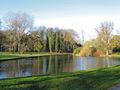
Trois anciennes forteresses dans un parc, aux bords de la Senne et du Canal Bruxelles-Escaut. Aucun ruisseau ne traverse ce parc, mais la connexion à l'eau est présente.
Le parc est situé sur la rive gauche du Canal Bruxelles-Escaut, adjacent à l'eau. Un peu plus loin, en parallèle au canal, la Senne serpente à travers le paysage.
La vaste station d'épuration Bruxelles-Nord, que vous pouvez voir d'ici, contribue depuis début 2008 à un assainissement de la Senne.
Téléchargez la brochure de randonnée :
http://www.gs-esf.be/downloads/topoguides/DrieFonteinen07_NL_LOW_A4.htm
Une publication de la Coordination Zenne-Coordination Senne, partenaire de Grenzeloze Schelde.
http://www.coordinatiezenne.be
http://www.grenzelozeschelde.org
Merci à Herman Dierickx - Natuurpunt.
Avec le soutien du gouvernement flamand.
See something wrong on this route?Add an issue
Navigate route in...
 RouteYou app Open
Don't want to see this ad anymore?
→ Upgrade now

Please wait, the navigation is being prepared.
You can now navigate. Have fun on the road!
Processing your request has failed. Please try again.
Don't want to see this ad anymore?
→ Upgrade now
Please wait, your download is being prepared.
Your download is ready. Have fun on the road!
Processing your request has failed. Please try again.
Don't want to see this ad anymore?
→ Upgrade now
Please wait, your print is being prepared.
Your print is ready to download. Have fun on the road!
Processing your request has failed. Please try again.
<iframe src="https://plugin.routeyou.com/routeviewer/free/?language=en&params.route.id=2512163&params.language=fr" width="100%" height="600" frameborder="0" allowfullscreen></iframe>
<p><a class="routeYou_embed" href="https://app.routeyou.com/fr-be/route/view/2512163?utm_source=embed&utm_medium=article&utm_campaign=routeshare&navigation=external" title="Recherche d'un plan d'eau : Le parc Drie Fonteinen à Vilvoorde - RouteYou" target="_blank"><img src="https://image.routeyou.com/embed/route/960x670/2512163-fr@2x.png" style="width: 100%; height: auto;" alt="Recherche d'un plan d'eau : Le parc Drie Fonteinen à Vilvoorde"></a></p>
Additional feedback:
This feature is only available to RouteYou PREMIUM subscribers.
Try 1 month for free and discover the difference! We don't take any payment details, and your trial ends automatically after one month.
© 2006-2026 RouteYou - www.routeyou.com



 12021980






 Start
Start Download
 Download

