Link copied. Paste the link into Instagram to share the route.

Thanks to our partner De Wandelmaker you get free access to this route – and make your acquaintance with RouteYou PLUS.
Discover all benefits
De pueblo a pueblo – De Bilt – Lage Vuursche
Horas de caminata: 3,5
superficie pavimentada/no pavimentada: 55/45
Conexión más rápida entre el punto de inicio y el punto final:
Lage Vuursche, parada de autobús Dorp - Huis ter Heide, parada de autobús Pr. Alexanderweg, autobús 59
Huis ter Heide, parada de autobús Pr. Alexanderweg - De Bilt, parada de autobús Tunneltje, autobús 52
Tiempo de viaje aproximadamente 0:40, no los domingos, U-OV.
Esta ruta conecta las dos iglesias del pueblo de De Bilt y Lage Vuursche. La ruta atraviesa la zona de transición entre el Utrechtse Heuvelrug y la zona de turberas y lagos al norte de la ciudad de Utrecht.
La Nueva Línea de Agua Holandesa se hace visible en el fuerte Voordorp, justo fuera de De Bilt. También echa un vistazo a las actividades alrededor del De Hooge Kampse Plas, donde se está creando una nueva área natural por encargo del Utrechts Landschap.
La parcelación en franjas de la Edad Media se puede ver bien al norte de Groenekan. Por eso, la ruta también tiene esos 'largos tramos'.
A través de la finca Beukenburg con sus parcelas de madera de corta y hermosos senderos de hayas, se alcanza la finca Eyckenstein. A través de un hermoso camino con vistas, se llega a la Casa Eyckenstein.
Descansa allí un momento en la Mauritshoeve, durante años un lugar conocido para los excursionistas.
También puedes optar por continuar a través de los bosques y parar en una de las terrazas del pintoresco pueblo de De Lage Vuursche. En invierno, allí es un buen lugar para comer pancakes.
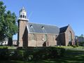
Al llegar a la iglesia Stulpkerk del pueblo, encontrarás el punto final de esta ruta.
See something wrong on this route?Add an issue
Navigate route in...
 RouteYou app Open

Please wait, your print is being prepared.
Your print is ready to download. Have fun on the road!
Processing your request has failed. Please try again.
Additional feedback:
This feature is only available to RouteYou PREMIUM subscribers.
Try 1 month for free and discover the difference! We don't take any payment details, and your trial ends automatically after one month.
© 2006-2026 RouteYou - www.routeyou.com



 De Wandelmaker






 Download


