Lien copié. Collez le lien dans Instagram pour partager l'itinéraire.

 Azure
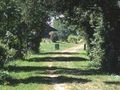
AzureThe Green Axis was born from an original idea that led to transform an old railway into a hiking trail, with the old stations converted into holiday cottages. From Guise to the gates of Hirson, with an extension to the abbey of Saint-Michel, the Green Axis accompanies the Oise, which descends from Belgium. In the serene landscape of this valley, adorned here and there with poplar beds, the river abandons on its flanks some marshes and ponds suitable for fishing and bird watching. For nearly 40 km, the path stretches, clear, marked with hotels and cottages, also open to other adventures (canoeing from the piers of Guise, Etréaupont, Autreppes or Hirson, or the discovery of a rich industrial memory around Hirson).
Vous avez remarqué quelque chose sur cet itinéraire ?Ajouter rapport
Parcourir l'itinéraire dans...
 Application RouteYou Ouvrez
Vous ne voulez plus voir cette publicité ?
→ Actualiser maintenant

Veuillez patienter, la navigation est en cours de préparation.
Vous pouvez maintenant naviguer. Bonne route !
Le traitement de la demande a échoué. Veuillez réessayer.
Vous ne voulez plus voir cette publicité ?
→ Actualiser maintenant
Veuillez patienter, votre téléchargement est en cours de préparation.
Votre téléchargement est prêt. Bonne route !
Le traitement de la demande a échoué. Veuillez réessayer.
Vous ne voulez plus voir cette publicité ?
→ Actualiser maintenant
Veuillez patienter, votre impression est en cours de préparation.
Votre impression est prête à être téléchargée. Bonne route !
Le traitement de la demande a échoué. Veuillez réessayer.
Commentaires supplémentaires :
Cette fonctionnalité est exclusivement disponible pour les abonnés RouteYou PREMIUM.
Essayez 1 mois gratuit maintenant et découvrez la différence ! Nous n'exigeons aucune donnée de paiement et le service s'arrête automatiquement après votre période d'essai d'un mois.
© 2006-2026 RouteYou - www.routeyou.com



 Aisne - Balades sur RouteYou






 Démarrer
 Télécharger
 Télécharger

