

The village used to located on the left bank of the Scheldt, but the river changed course during the 13th century, and it is now located on the right bank. The village was first mentioned in 1240 when it was sold to the Saint Bavo's Abbey in Ghent for cultivation. Around 1320, the area was enclosed by dikes. Weert was an independent municipality until 1977, when it was merged into Bornem.
Font: Wikipedia.org
Drets d'autor: Creative Commons 3.0
 | | Pública | Alemany • Danès • Espanyol • Francès • Italià • Neerlandès
Direcció: Bornem,Weert, Antwerpen, Bèlgica
Estadístiques
Seleccioneu una de les activitats més populars a continuació o perfeccioneu la cerca.
Descobriu les rutes més boniques i conegudes de la zona, acuradament agrupades en seleccions adequades.
Font: Torsade de Pointes
Drets d'autor: Public domain
Seleccioneu una de les categories més populars a continuació o inspira't en les nostres seleccions.
Descobriu els llocs d'interès més bonics i coneguts de la zona, acuradament agrupats en seleccions adequades.
Font: Torsade de Pointes
Drets d'autor: Public domain
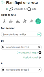
Amb RouteYou pots crear mapes personalitzats molt fàcilment. Defineix la teva ruta, afegeix waypoints o interseccions, planifica parades a punts d'interès o a establiments per menjar i beure i comparteix-ho tot amb els amics i la família.
Planificador de rutes
<iframe src="https://plugin.routeyou.com/poiviewer/free/?language=ca&params.poi.id=1673914&params.language=en" width="100%" height="600" frameborder="0" allowfullscreen></iframe>

Més de 11.800.000 rutes

Més de 15.000.000 usuaris

Més de 4.500.000 llocs d'interès

Kerkstraat 108
9050 Gentbrugge, Bèlgica
© 2006-2026 RouteYou - www.routeyou.com



