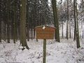
The Semweder Berg is located in the southeast of the Dümmer Nature Park. With its 181 meters above sea level, it is the last elevation before the lowlands of northern Germany. To the south lies the park-like cultural landscape of the municipality of Stemwede. To the east of Lake Dümmer is the Oppenweher Moor. The Stemweder Berg is made up of limestones from the Late Cretaceous period. This soft limestone contains imprints of shells, as well as whole shells. Various fossils are exhibited in the Dümmer Museum in Lembruch. The forest mainly consists of beech trees. Here, there are two large areas of the extremely rare masterwort beech forests. In the Stemweder Berg, various historical boundary stones can be discovered. Due to the Peace of Westphalia in 1648, Minden and the area south of the Stemweder Berg came under Brandenburg's (Prussia's) jurisdiction. High-stemmed orchard meadows provide habitat for dormice, little owls, and various bat species. Water quickly seeps away in the Ice Age dry valleys of the Stemweder Berg. Only small, shallow ponds are present in a limited area. In addition to local wildlife such as deer, hares, pheasants, and foxes, the lesser spotted woodpecker and the black woodpecker can be found. Also present are primroses, cuckoo-pint, lily of the valley, native orchids, and masterwort. This extensive forest area is accessible through well-developed and marked hiking trails of varying lengths, each starting at a hiking parking lot. The overview boards and the hiking map provide information and help with orientation. All routes are also suitable for walking or jogging.
See something wrong on this route?Add an issue
Navigate route in...
![]() RouteYou app Open
RouteYou app Open
Don't want to see this ad anymore?
→ Upgrade now
![]()
Please wait, the navigation is being prepared.
You can now navigate. Have fun on the road!
Processing your request has failed. Please try again.
Don't want to see this ad anymore?
→ Upgrade now
![]()
Please wait, your download is being prepared.
Your download is ready. Have fun on the road!
Processing your request has failed. Please try again.
Don't want to see this ad anymore?
→ Upgrade now
![]()
Please wait, your print is being prepared.
Your print is ready to download. Have fun on the road!
Processing your request has failed. Please try again.
<iframe src="https://plugin.routeyou.com/routeviewer/free/?language=en&params.route.id=14120540" width="100%" height="600" frameborder="0" allowfullscreen></iframe>
<p><a class="routeYou_embed" href="https://app.routeyou.com/en-de/route/view/14120540?utm_source=embed&utm_medium=article&utm_campaign=routeshare&navigation=external" title="Stemweder Berg hiking trail Orange dashed - RouteYou" target="_blank"><img src="https://image.routeyou.com/embed/route/960x670/14120540-en@2x.png" style="width: 100%; height: auto;" alt="Stemweder Berg hiking trail Orange dashed"></a></p>
Additional feedback:
This feature is only available to RouteYou PREMIUM subscribers.
Try 1 month for free and discover the difference! We don't take any payment details, and your trial ends automatically after one month.
© 2006-2026 RouteYou - www.routeyou.com