 Azure
AzureFrom: Drohmbergstraße 1, 02692 Großpostwitz/O.L., Saxony, Germany
To: Drohmbergstraße 1, 02692 Großpostwitz/O.L., Saxony, Germany
Routing: Hiking - most beautiful
Hiking trail Rascha - Pielitzhöhe ![]()
Rascha - Panoramaweg Drohmberg (western and southern slope) - Kleinkunitz - Cosul - Großkunitz - Pielitzhöhe - Schönberger Pass (4.5 km) and back via the blue dot: quarries - Cosul - Cosuler Tal - Alt-Hainitz - Rascha (total: 10.5 km)
The classic Upper Lusatia hike of the people of Bautzen has been raved about before:
You took the bus to the famous inn "Zum Drohmberg" and then hiked off, following the green dot as a marker. ![]()

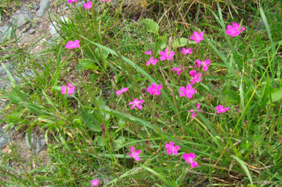
It goes steeply uphill for a short distance. The fire carnations inks on the hillside, which delighted us when we were children, are still standing and blooming in summer.
At the junction at the top of the western slope of Rasha's local mountain, we used to hold our witch burning on April 30th. In the wide area you could see the witch fires in Großpostwitz am Sonneberg, Berge, Lehn, Mönchswalde, Blumental and other places shining. What a great spectacle it was. We had collected the wood as Rascha children and young people weeks earlier in the forest of the Drohmberg.
Now the dog bank is here as a starting point for those who walk their faithful companion here as often as possible and thus combine a walk in the most beautiful surroundings. The bank was set up in 2003. What a look when we turn around!
Now we keep to the right and it immediately becomes clear to us why this is the panorama path of the Drohmberg .
Soon it goes a bit through the forest, which experienced a clear cut here in 2019/20. Excessively dry summers in 2018 and 2019, followed by heavy storms and then masses of bark beetles led to deforestation, especially of spruce.
From 1905 to 1910 there was already considerable forest loss, at that time it was a nun's plague in large parts of Upper Lusatia. Around 1830, the mountain also appeared quite bare, because it was used as a hut.
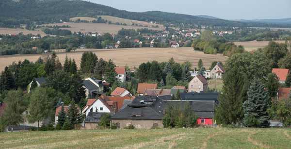
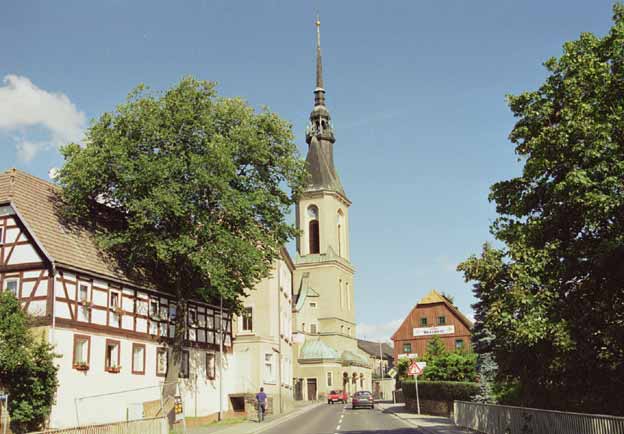
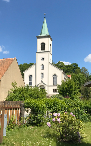
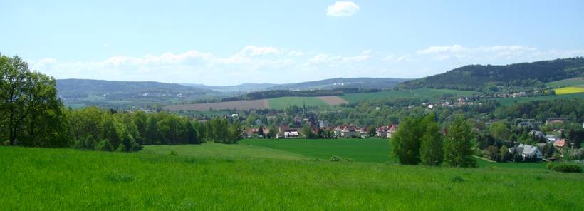
We have now reached the old Hainitzer Flur on the right-hand side, Raschaer Flur accompanies us on the left. When we step out of this clearing area, there was already a bench here 100 years ago. Today there are two. Along the slopes of the legendary mountain, there have always been first-class panoramic views to the south. Here at the first bank, for example: Down to Großpostwitz with its beautiful landmark. It is the Protestant church, which was rebuilt and consecrated in 1893, with a 60-metre-high tower in a perfectly slender shape.
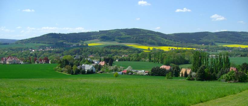
To the right of the path, the view sweeps over to the Mönchswalder Berg (447 m, with tower and inn since 1885). To the south are the calf stones (487 m), at the foot of which Crostau is located. This place (again with the great view to the north of our Drohmberg) contains the only Silbermann organ in Upper Lusatia in its church.
In addition, further back in the south, Schirgiswalde, the pearl of Upper Lusatia with its double-towered Catholic church, and on the southern horizon even the Botzen/Partyzynsky vrch near Schluckenau in the Bohemian Netherlands (Northern Bohemia, CZ) greets you. It was once 538 m high. Unfortunately, it will soon be completely eroded, because its basalt is a sought-after building material (chippings and gravel in various grain sizes). The legend warns: If the Botzen disappears, hard times will begin in the Schluckenau area. Right next to it on the left we can see the Pirsken/Hrazeny with 610 m in the shape of a table mountain.
A picture from my childhood, when you could still see the train from Großpostwitz to Cunewalde or Wilthen in front of the Sonneberg (the route is behind the church), I still have vividly in mind. However, the overgrowth would urgently need to be reduced in order to restore the panorama trail to its old viewing language. But we are now walking all the time on solid crystalline ground (granodiorite, 540 million years old). On the right, a farm road comes up from Althainitz and on the left, a path soon branches off diagonally upwards. But our green dot leads us straight ahead. Before a second farm road, coming from Althainitz, joins on the right, we have left the old corridor of Rascha and are on the Ebendörfler corridor. This extends over the summit of the Drohmberg and right down to the Kunitzer Wasser. When we step out of the forest, Kleinkunitz is soon in sight. At the top left of the edge of the forest is the forester's house. The small farming hamlet never had more than 4 houses. It was not until 1550 that it was mentioned as Bautzener Ratsdorf. The central place of the small village is the rest area at the pond. The Siebenhügelweg comes in here from Bautzen and continues to the Bieleboh.
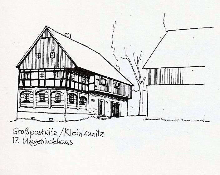
Kleinkunitz No. 2 is a listed building
Once there was the meadow path at the Kunitzer Wasser, which led us on to Großkunitz. Today we have to take the small detour via Cosul , together with the green line. On the left, at the former inn "Zur Linde", we turn immediately again and continue to climb in this Großpostwitz district.

At the next signpost, we continue straight ahead to our green dot. As soon as we reach Großkunitz, our hiking trail turns right again behind the birches into the hollow path.
Großkunitz lies in the headwaters of the Kunitzer Wasser and is probably an extension of the Pielitz manor. Today, both places belong to the greater municipality of Kubschütz. The houses No. 10 (two-sided farm, on the left edge of our hiking trail green dot) and behind it No. 12 with a beautiful surrounding area are listed as historical monuments.
We now continue to climb to the second and last house, which stands at the top in front of the edge of the forest.
What an idyllic spot this is! If we turn around, we have a great view back to Drohmberg and Schmoritz.

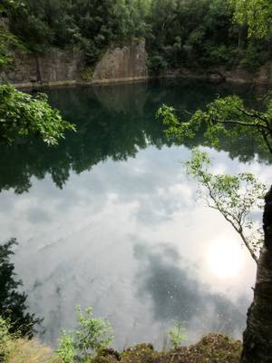
After a rest, it goes through the forest on the edge of the Pielitzhöhe up to the Schönberg Pass road. Here, shortly before, our hiking trail picks up the yellow line that joins the left, which comes from the Rote Schenke. On the road, there is a connection to the main hiking trail with the blue dot, once called the Northern Ridge Trail. This would lead us to the Czorneboh. For our way back, however, we take it in the opposite direction to the right over the former quarry site of the Pielitzhöhe, first to Cosul ![]() .
.
Before we reach the village, after leaving the forest, a great view of the saddle of the Drohmberg and the Schmoritz opens up again. Behind Cosul follow the beautiful Cosuler Tal and Althainitz. Here we can leave the blue dot and thus the road before the B96. Behind the old fountain we turn right to descend into a valley. In the depression we cross the Hainitzer Wasser. The former Luther School and the Rascha settlement are left behind. After passing the former sand pit on the right at the edge of the forest, we return to Racha.
See also Marked hiking trails on Drohmberg and Schmoritz
Route/tour: 10.5 km
See something wrong on this route?Add an issue
Navigate route in...
![]() RouteYou app Open
RouteYou app Open
Don't want to see this ad anymore?
→ Upgrade now
![]()
Please wait, the navigation is being prepared.
You can now navigate. Have fun on the road!
Processing your request has failed. Please try again.
Don't want to see this ad anymore?
→ Upgrade now
![]()
Please wait, your download is being prepared.
Your download is ready. Have fun on the road!
Processing your request has failed. Please try again.
Don't want to see this ad anymore?
→ Upgrade now
![]()
Please wait, your print is being prepared.
Your print is ready to download. Have fun on the road!
Processing your request has failed. Please try again.
<iframe src="https://plugin.routeyou.com/routeviewer/free/?language=en&params.route.id=8497914" width="100%" height="600" frameborder="0" allowfullscreen></iframe>
<p><a class="routeYou_embed" href="https://app.routeyou.com/en-de/route/view/8497914?utm_source=embed&utm_medium=article&utm_campaign=routeshare&navigation=external" title="Drohmberg Panorama Trail - RouteYou" target="_blank"><img src="https://image.routeyou.com/embed/route/960x670/8497914-en@2x.png" style="width: 100%; height: auto;" alt="Drohmberg Panorama Trail"></a></p>
Additional feedback:
This feature is only available to RouteYou PREMIUM subscribers.
Try 1 month for free and discover the difference! We don't take any payment details, and your trial ends automatically after one month.
© 2006-2026 RouteYou - www.routeyou.com


