Link copied. Paste the link into Instagram to share the route.

As si trova sull'Altopiano del Kempen a un'altitudine di circa 75 metri. Si trova sulla riva destra della valle del Bosbeek, che qui è incisa nell'altopiano.
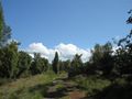
Aree boschive e di brughiera coprono quasi il 60 percento della superficie di As. Soprattutto nel nord-ovest del comune si trovano aree naturali, come il Klaverberg e la riserva naturale Heiderbos. Quest'ultima è unica in Flandria per l'alta concentrazione di arbusti di ginepro. Non lontano si trovano anche le due cime delle ex miniere di carbone di Waterschei, con altezze fino a 165 metri sul livello del mare. Le cime sono parzialmente ristrutturate e piantumate e ospitano, grazie al loro specifico terreno e pendio, una flora e fauna uniche che amano il calore.
Punto di partenza e arrivo: Schutterij Sint-Sebastiaan, Kantonnale baan, 3665 As
See something wrong on this route?Add an issue
Navigate route in...
 RouteYou app Open
Don't want to see this ad anymore?
→ Upgrade now

Please wait, the navigation is being prepared.
You can now navigate. Have fun on the road!
Processing your request has failed. Please try again.
Don't want to see this ad anymore?
→ Upgrade now
Please wait, your download is being prepared.
Your download is ready. Have fun on the road!
Processing your request has failed. Please try again.
Don't want to see this ad anymore?
→ Upgrade now
Please wait, your print is being prepared.
Your print is ready to download. Have fun on the road!
Processing your request has failed. Please try again.
Additional feedback:
This feature is only available to RouteYou PREMIUM subscribers.
Try 1 month for free and discover the difference! We don't take any payment details, and your trial ends automatically after one month.
© 2006-2026 RouteYou - www.routeyou.com


 Blauwkruikje




 Start
 Download
 Download


