Link copied. Paste the link into Instagram to share the route.

As está situado en la meseta de Kempen a una altura de aproximadamente 75 metros. Se encuentra en la ladera derecha del valle del Bosbeek, que se ha ido esculpiendo aquí en la meseta.
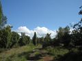
Las áreas boscosas y de brezo abarcan casi el 60 por ciento de la superficie de As. Especialmente en el noroeste del municipio se pueden encontrar áreas naturales, como Klaverberg y la reserva natural Heiderbos. Esta última es única en Flandes debido a la gran concentración de arbustos de enebro. También cerca se encuentran los dos terrils de la antigua mina de carbón de Waterschei, con picos de hasta 165 metros sobre el nivel del mar. Los terrils han sido parcialmente reconstruidos y plantados y albergan debido a su suelo y pendiente específicos una flora y fauna única que ama el calor.
Salida y llegada: Schutterij Sint-Sebastiaan, Kantonnale baan, 3665 As
See something wrong on this route?Add an issue
Navigate route in...
 RouteYou app Open
Don't want to see this ad anymore?
→ Upgrade now

Please wait, the navigation is being prepared.
You can now navigate. Have fun on the road!
Processing your request has failed. Please try again.
Don't want to see this ad anymore?
→ Upgrade now
Please wait, your download is being prepared.
Your download is ready. Have fun on the road!
Processing your request has failed. Please try again.
Don't want to see this ad anymore?
→ Upgrade now
Please wait, your print is being prepared.
Your print is ready to download. Have fun on the road!
Processing your request has failed. Please try again.
Additional feedback:
This feature is only available to RouteYou PREMIUM subscribers.
Try 1 month for free and discover the difference! We don't take any payment details, and your trial ends automatically after one month.
© 2006-2026 RouteYou - www.routeyou.com


 Blauwkruikje




 Start
 Download
 Download


